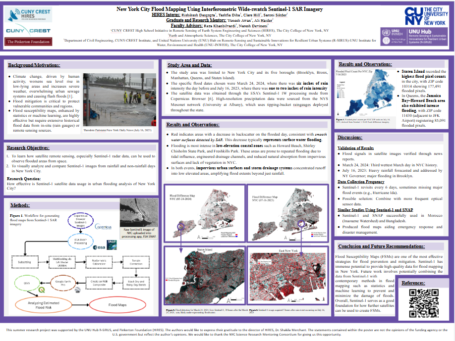
New York City Flood Mapping Using Interferometric Wide-swatch Sentinel-1 SAR Imagery
Nuclear Waste: Transportation Across U.S. and the Globe
Systematic Review of Means and Effects of Nuclear Energy Usage as Opposed to Modern Fossil Fuel Reliance
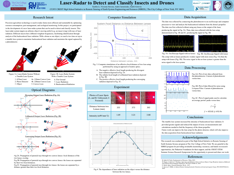
Laser-Radar to Detect and Classify Insects and Drones
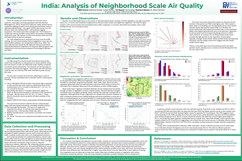
India: Analysis of Neighborhood Scale Air Quality
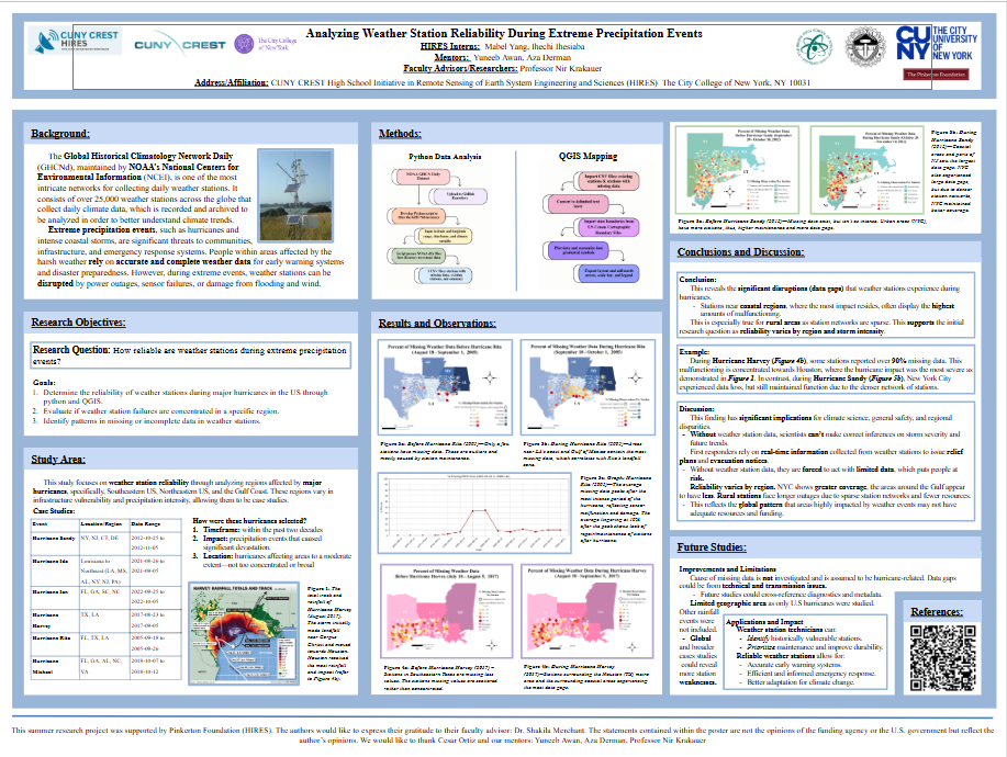
Analyzing Weather Station Reliability During Extreme Precipitation Events
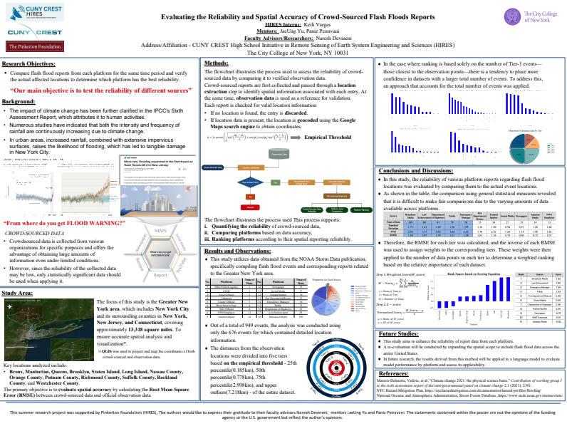
Evaluating the Reliability and Spatial Accuracy of Crowd-Sourced Flash Floods Reports
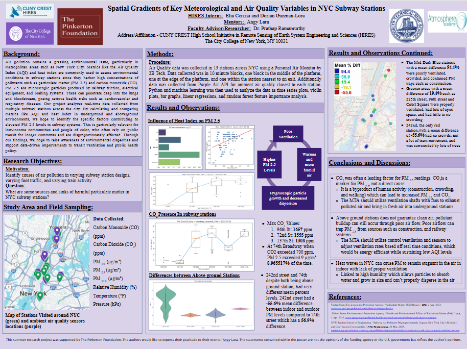
Spatial Gradients of Key Meteorological and Air Quality Variables in NYC Subway Stations
Natural, Nature-Based, and Hard Shorelines in Urban Settings: Analyzing Urban Flooding and Community Engagement
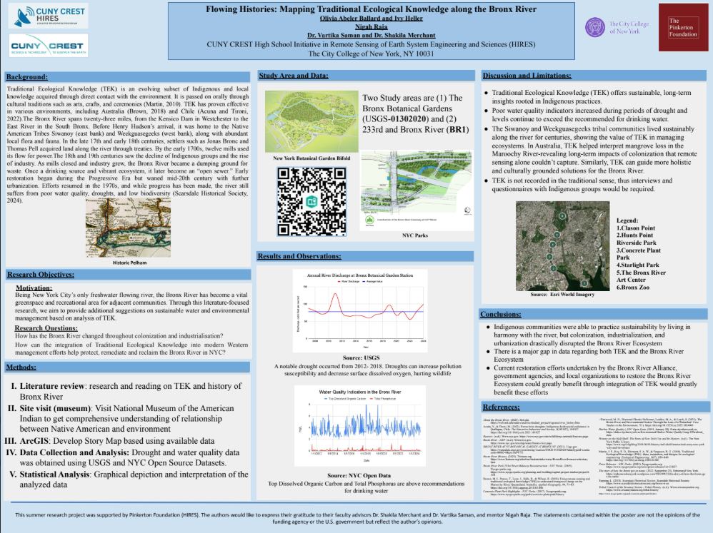
Flowing Histories: Mapping Traditional Ecological Knowledge along the Bronx River
Analyzing the Capability of Large Language Models in Extracting Landslide Event Data
A Comparative Study of Large Language Models’ Performances in Estimating Flood Depths from Textual Reports
Hydrological Analysis of The Hudson And Aroostook Rivers: Flood vs. Drought, And Traditional Ecological Knowledge (tek) of The Mohican and Mi’kmaq Nations
Validation of Remote Sensing Reflectance From OC Sensors