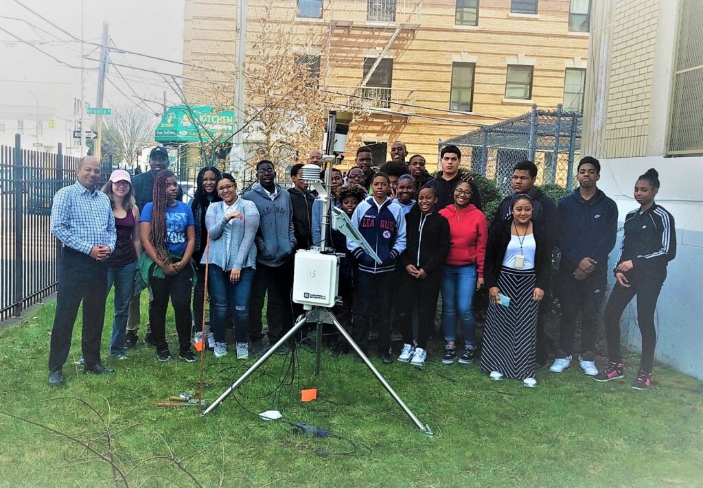
CUNY NYC-uHMT
Monitoring micro-climate variables within cities that have a high accuracy for a better urban resilience to climate change is an ongoing challenge. Assessing the Intra-urban characteristics of a city is vital to ensuring better living standards. Urban meteorological networks and automated data acquisition is highly needed for modern urban climate monitoring, evaluation, and analysis. Following research questions are being investigated using NY-uHMT datasets: How does incorporation of urbanization data into the flash flood guidance system by creating the static grid/pixels help identify and isolate areas where land development has altered the runoff characteristics in NYC?; What role does soil moisture deficit between the urban and surrounding rural areas play in exacerbating urban air temperature? And how does it impact the micro-climate of the cities: local and regional?; Can integration of ground based in-situ observation with radar and urbanized Weather Research and Forecasting (uWRF) model (used to understand the spatial and temporal distribution of heavy rainfall that are influenced by urban heat island, urban canopy and urban aerosols) be updated by higher resolution soil moisture records?
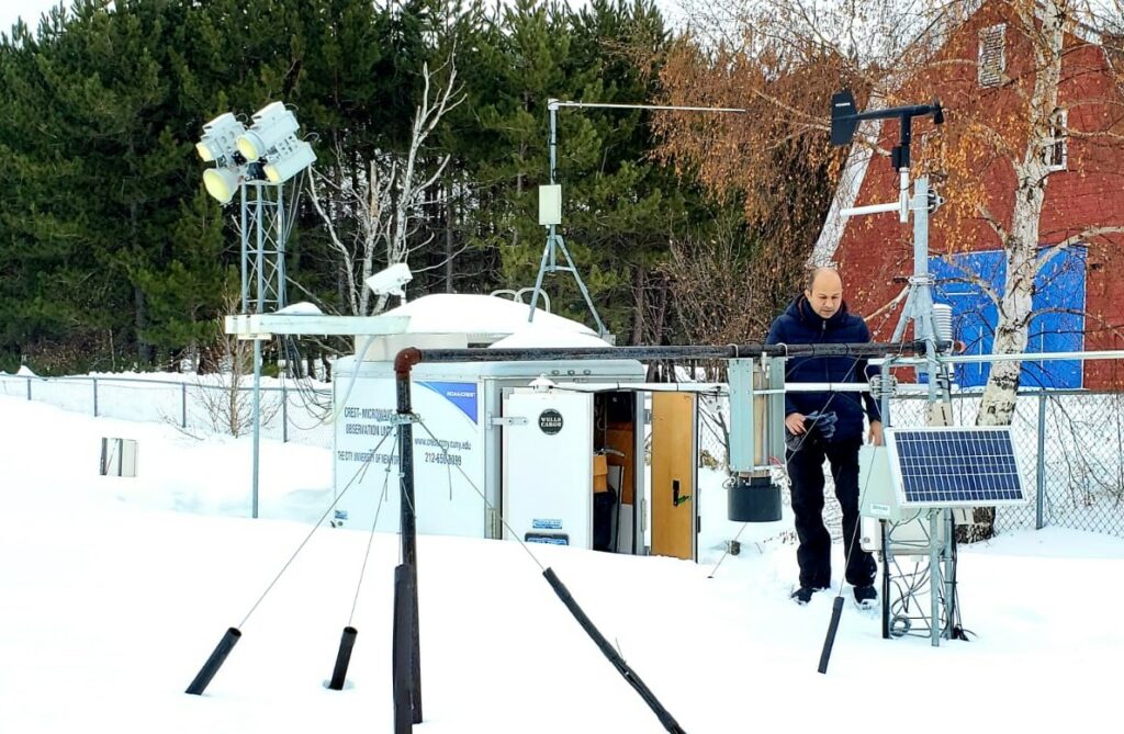
CUNY-SAFE (Snow)
Since 2010, the CUNY-Snow Analysis and Field Experiment (CUNY-SAFE) is conducted each winter. The field experiment site is located on the premises of Caribou Municipal Airport and National Weather Service office at Caribou, ME at 46°52’00.9N and 68°00’47.9W Owing to its humid continental climate, Caribou is the ideal location to study snow. It’s usual seasonal snowfall is approximately 116 inches (2.9 m). The record snowfall is 197.8 inches (5.02 m) from the winter of 2007-2008. Field observation data includes synoptic/meteorological parameters, radiation fluxes, and measured microwave emission (brightness temperature) at 10, 19, 37 and 89 GHz, vertical and horizontal polarization. In addition to dual polarized microwave radiometers, the field experiment site is equipped with Gamma radiation sensor (to measure Snow Water Equivalent), CIMEL Sunphotometer, ultrasonic snow depth sensor, infrared thermometer (for snow skin temperature), net radiation sensors, humidity, temperature, snow temperature profiler (measures temperature at every 5 cm of snow layer), snow grain size, density, and network camera for real time remote monitoring. The objective of this long term field experiment is to characterize the behavior of snow-emitted microwave radiation throughout the winter season. The experiment examines and interprets the effect of snowpack temperature (related to dry and wet snow conditions) on the microwave brightness temperature.
Coastal Observatory – LISCO
Advances in oceanic bio-optical processes are expected to be more heavily focused on improving satellite retrieval products of inherent optical properties (IOPs) of coastal waters, which, because of their complexity, offer more challenges than open ocean waters, where satellite observations and retrieval algorithms are already reasonably effective.
Remote Sensing of Soil Moisture (CREST-SMART and PR-SMART)
CREST-SMART (Soil Moisture Advanced Radiometric Testbed) field campaign aims to improve microwave radiative modeling of soil–vegetation systems and improve the understanding of soil–plant–atmosphere interactions. It consists of two components: (i) microwave remote sensing using L-band radiometry, (ii) a comprehensive network of ground measurements of soil moisture. The objectives of campaign are: (i) to contribute towards a better understanding of the different processes affecting the microwave signal, (ii) to test as well as improve the soil moisture retrieval algorithms from dual polarized and multi-angular measurements, and (iii) to validate satellite based soil moisture products against in situ observations.
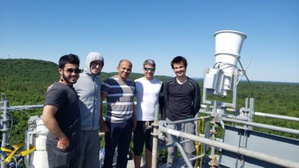
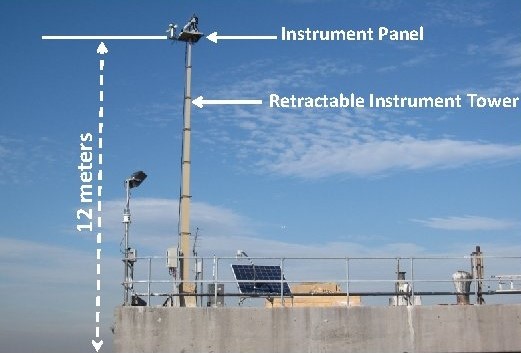
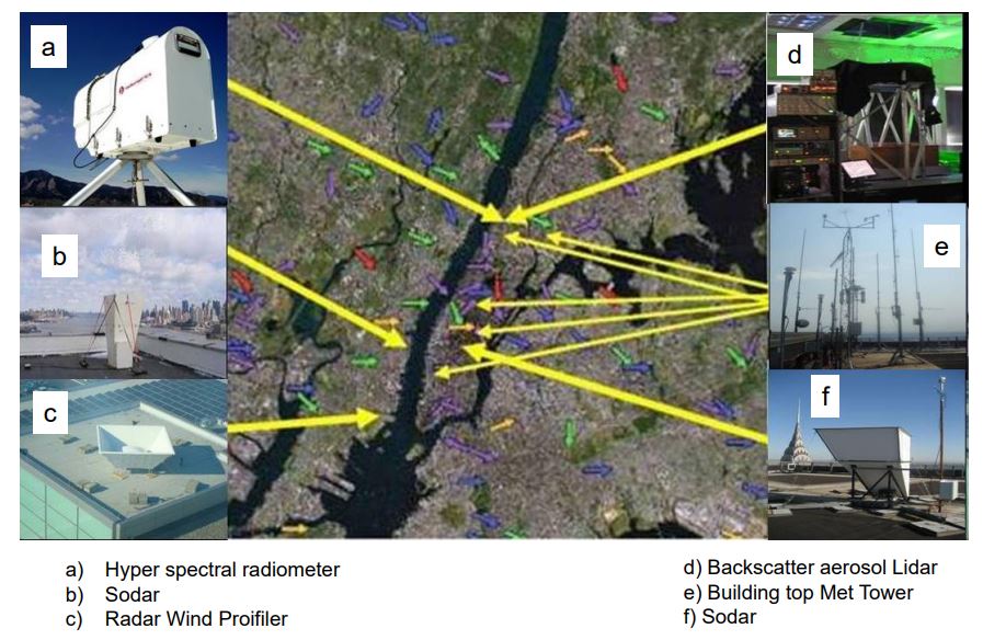
NYCMetNet
The latest meteorological observations in and around The New York metropolitan area (NYC) at NYCMetNet, provided by the Remote Sensing Laboratory of The City College of New York. Observations are updated every 15 minutes to better characterize meteorological conditions within the NYC urban environment. Surface observations consist, in part, of near real-time atmospheric pressure, relative humidity, temperature, wind direction, wind speed, rain rate, and total rain accumulation measurements at building-top sites. Upper air measurements from SODAR and radar wind profilers consist of wind speed and direction at various altitudes in near real-time. Several weather forecast and predictive tools are also provided, such as NWS Doppler Radar maps of the extended NYC metropolitan area, NDFD forecast weather conditions for selected NYC areas, animated GOES infrared cloud cover images from our CUNY CREST Satellite Receiving Station, and Thunderstorm Now-casting.
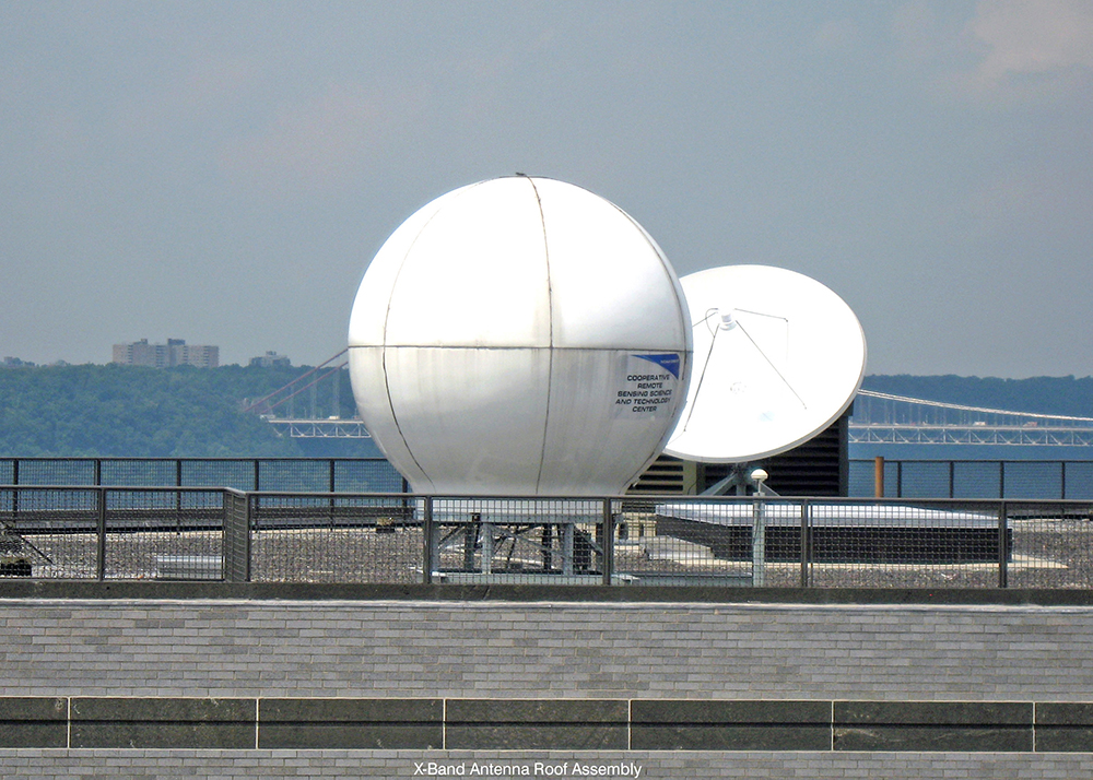
Direct Broadcast Services – Satellite Receiving Stations
The Satellite Receiving Station (SRS) located at 3 Locations, CUNY, Hampton University and University of Puerto Rico, Mayaguez. Data types that can be received and processed are from X-band transmitting polar orbiting satellites, Suomi NPP, NOAA-18, NOAA-19,Terra and Aqua, both equipped with MODIS instruments, and L-band data from the geostationary (GEOS-12) satellite (only at CUNY).