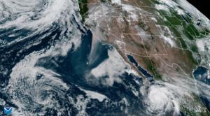
An institute that addresses a breadth of Earth systems scientific and remote sensing technological research encompassing and integrating a variety of instrument developments, retrieval technique implementations and analytical method applications.
Research Focuses:
Conduct Fundamental & Applied Research on Earth System Sciences
Conduct research to establish and/or improve the understanding of phenomena linking fundamental physical processes to parameters that have the potential to be observed through remote sensing techniques. Characterize linkages of fundamental phenomena to need-based applications. The focus of CREST Institute research in this regard is on phenomena observable by remote sensing or that are able to be characterized within the context of an integrated construct of modeling and remote sensing.
Develop RS Techniques and Technologies
Perform research on furthering existing remote sensing capabilities or developing new remote sensing approaches suitable for characterizing Earth system phenomena. This spans the breadth of technology and instrument development, measurement technique, and algorithm development.
Develop Remote Sensing Analysis Methods
Develop advanced, multi-variate, remote sensing retrieval methods that determine multiple quantities from multiple instruments, working towards “whole satellite” and multi-satellite analysis approaches. Develop advanced multi-variate, non-linear analysis methods that diagnose process-relationships from multiple data products.
We will develop statistical algorithms based on machine learning/data mining methodology such as clustering for analysis and visualization of large and complex multi-variate data records. For example, global long-term reanalysis data records of physical variables may contain artifacts due to changes in modeling parameter choices, as or to the to the assimilation of data from different remote sensing instruments over time. These variations may be difficult to see from the conventional analysis of aggregate means since normalization is often applied to minimize such artifacts. We will develop methods to detect such artifacts, as well as providing methods to compare measured data with modeled data, ground measurements with space based measurements, and visualizing the dynamics of these large and complex data sets.
Integrated Data Products
Combine multiple data products into collections that quantitatively diagnose the process relationships that control the main Earth System cycles: energy, water and bio-geochemistry. Produce integrated data products that are global in extent and cover long-periods of time (years to decades) with sufficient space-time resolution to determine process behavior and infer their feedbacks on Earth System cycles.
We will develop statistical algorithms based on machine learning/data mining methodologies for analysis and visualization of large and complex multivariate data records. We will also develop these methods for detecting artifacts in long data records as well as for comparing measured and modeled quantities and ground-based and space-based measurements.
Develop Physical Models at Different Scales
Develop physically and statistically based models supporting the understanding of physical processes that support the objectives of CREST Institute research, including local, regional, continental and global scales, as appropriate to the need. Models will support development, analysis and interpretation of remote sensing data sets, and/or the incorporation of remotely seined data within integrated analysis frameworks.
Design and Deploy Observational Systems and Networks
Develop and deploy in situ and remote sensing systems and networks. Develop a collaborative infrastructure that will allow researchers to explore, visualize and combine data from a variety of data sources including remotely sensed data, multi-product global long-term data records, as well as economic and public health data. Unlike current GIS systems that require learning a proprietary or custom language, the goal of this system is to let scientists use the languages and tools they currently use in their research, while providing an environment which leverages cloud technologies to allow them to share their experiments and results. This will facilitate collaboration between scientists, technology transfer from research to operations, participation of students in research, as well as rapid dissemination of research results to the public.
Research Synopsis
The CUNY CREST Institute’s scientists seek to provide comprehensive answers to scientific and applied questions about the fundamentals of the Earth Systems sciences such as: climate, coasts and atmosphere interaction, energy, food and agriculture, water, hazards, and ecosystems. The research normally is being conducted in the laboratories, university campuses, field campaigns, and in some cases extends to places in regional and global scales. The scientific team is focusing on use-inspired research where technology is being applied and where new scientific questions emerge.
The complex nature that CREST Institute research is focusing on requires interdisciplinary research, and to accomplish that the institute reaches across the CUNY Campuses, other partnering universities and industrial partners/stakeholders to forge collaborations among experts, faculty, and scientists, and in a variety of disciplines, from engineering to sciences, , from sciences to social sciences, and from social sciences to environmental justice and policy.
The Institute’s Research Synopsis is centered around these research areas:
- Climate changes and its impacts on society
- Resiliency in the face of Climate Change
- Remote Sensing of the Ecosystem (Atmosphere, Land, Water and Coastal)
- Remote Sensing of Solar Energy
- Integration of in Situ and Satellite Observations
- Atmospheric Modeling and Analysis
- Monitoring and Modelling Air Quality-Aerosols and Ozone Studies
- Application of Data Science and Cloud Computing in Environmental Data Analysis
- Extreme Water Prediction (Flood, Droughts, and Water Demand)
- Extreme Weather Impacts on Urban Infrastructure, Energy and Transportation
- Land Surface Modeling (including Hydrology and Vegetation)
- Snow Observation and Modelling
- Biogeochemical analysis and monitoring of coastal waters
To realize the CUNY CREST Institute research vision, several Centers, Labs, and Groups are affiliated with the Institute.

