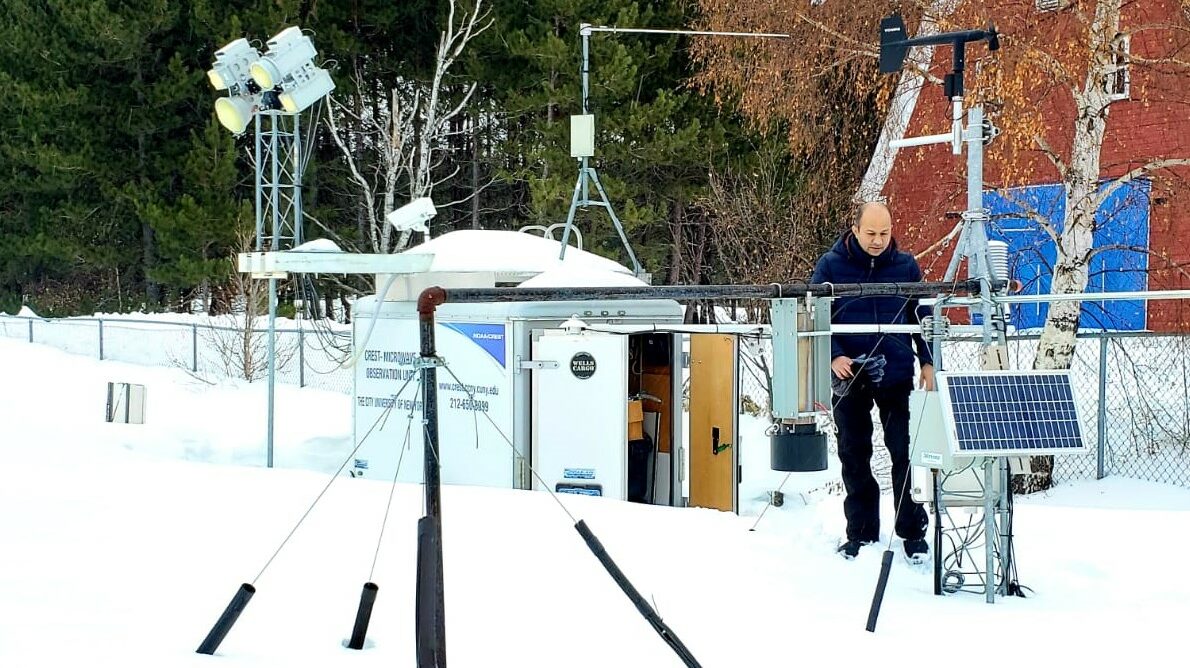
Snow Remote Sensing and Field Experiment (CUNY-SAFE)
Since 2010, the CUNY-Snow Analysis and Field Experiment (CUNY-SAFE) field experiment site located on the premises of Caribou Municipal Airport and National Weather Service office at Caribou, ME (46°52’00.9N and 68°00’47.9W) measure various snow observations. It’s usual seasonal snowfall is approximately 116 inches (2.9 m). The record snowfall is 197.8 inches (5.02 m) from the winter of 2007-2008. Field observation data includes synoptic/meteorological parameters, radiation fluxes, and measured microwave emission (brightness temperature) at 10, 19, 37 and 89 GHz, vertical and horizontal polarization. In addition to dual polarized microwave radiometers, the field experiment site is equipped with Gamma radiation sensor (to measure Snow Water Equivalent), CIMEL Sunphotometer, ultrasonic snow depth sensor, infrared thermometer (for snow skin temperature), net radiation sensors, humidity, temperature, snow temperature profiler (measures temperature at every 5 cm of snow layer), snow grain size, density, and network camera for real time remote monitoring. https://crest.cuny.edu/snow/
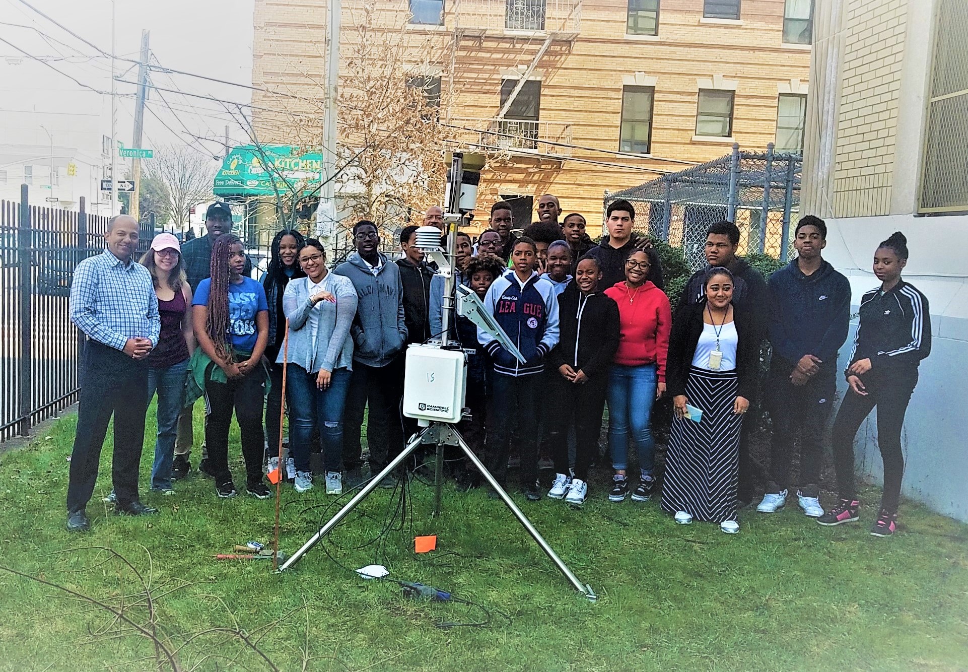
Urban Hydro-meteorological Testbed (NYC-uHMT)
Dotted around four of New York’s five boroughs are 20 autonomous mini-meteorological stations established by The City College of New York-based CUNY CREST Institute. This is part of CCNY’s singular response to the rising seas and extreme weather conditions in the city caused by climate change.
Dubbed the NY-uHMT (New York Urban Hydrometeorological Testbed) project, it is a one of a kind high-density hydro-meteorological weather network, according to the New York City Mayor’s Office of Recovery and Resiliency, a partner in the venture. In addition, data produced from the NY-uHMT stations will be available to the general public, agencies and researchers through open access servers located at center website. Urban meteorological networks and automated data acquisition is highly needed for modern urban climate monitoring, evaluation, and analysis. Following research questions are being investigated using NY-uHMT datasets: How does incorporation of urbanization data into the flash flood guidance system by creating the static grid/pixels help identify and isolate areas where land development has altered the runoff characteristics in NYC? https://crest.cuny.edu/uHMT/
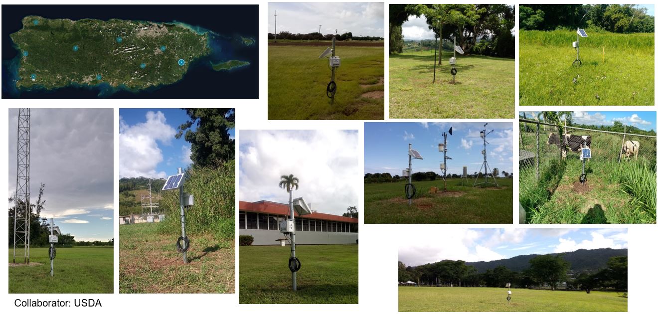
Remote Sensing of Soil Moisture (CREST-SMART and PR-SMART)
CREST-SMART (Soil Moisture Advanced Radiometric Testbed) field campaign aims to improve microwave radiative modeling of soil–vegetation systems and improve the understanding of soil–plant–atmosphere interactions. It consists of two components: (i) microwave remote sensing using L-band radiometry, (ii) a comprehensive network of ground measurements of soil moisture. The objectives of campaign are: (i) to contribute towards a better understanding of the different processes affecting the microwave signal, (ii) to test as well as improve the soil moisture retrieval algorithms from dual polarized and multi-angular measurements, and (iii) to validate satellite based soil moisture products against in situ observations. https://crest.cuny.edu/smart/
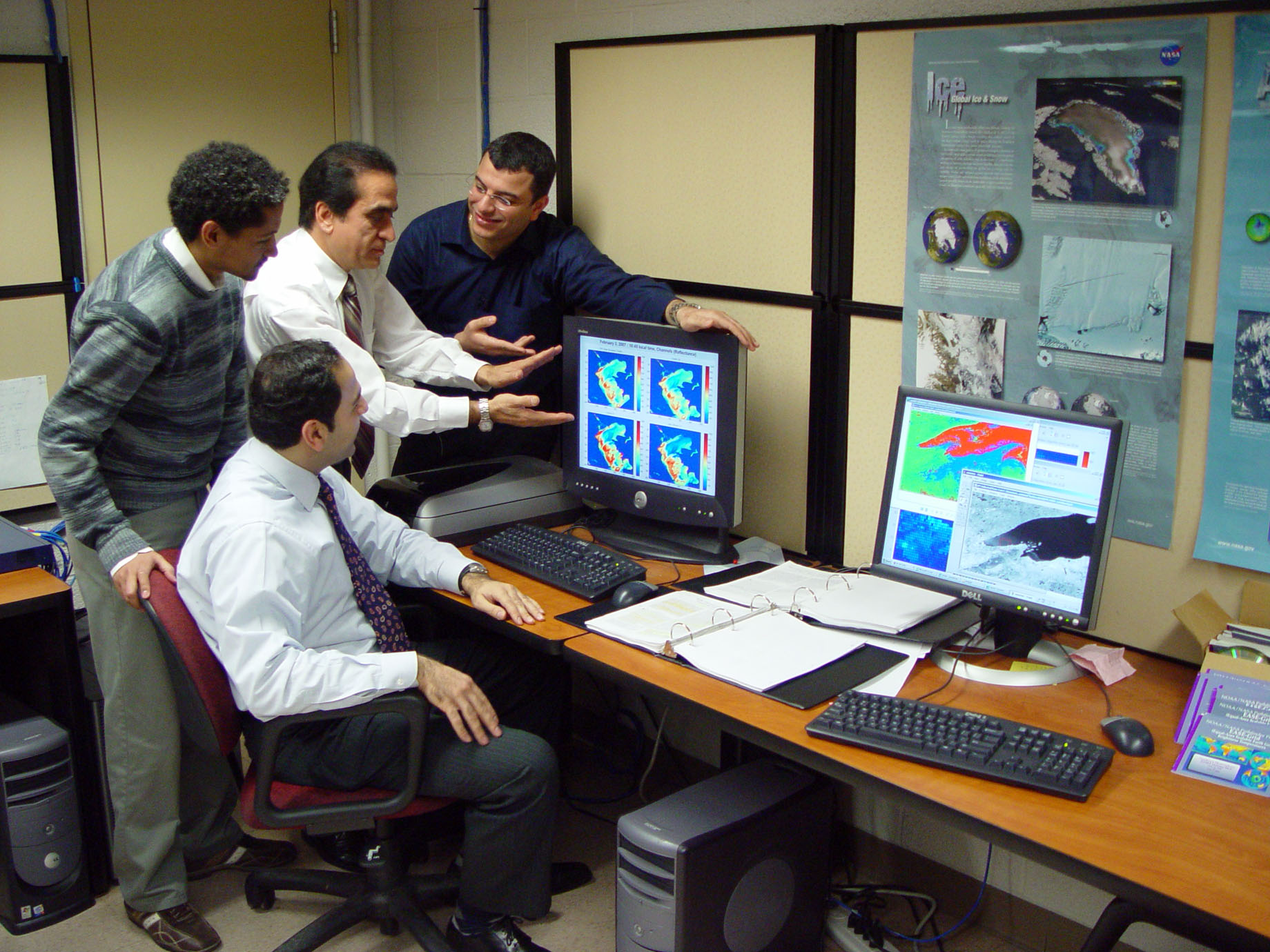
Remote Sensing and Geographic Information Systems (RS-GIS) Computer Lab
The RS/GIS Computer Lab (located at CM7, Steinman Hall) helps provide specialized hands-on assistance with satellite data and GIS software to CUNY-CREST students, faculty, and staff. It also assists students to find, manage, analyze, and visualize geospatial, numeric, and textual data. Further, it provides a forum for a comprehensive education in geographic information systems and remote sensing. Center’s research theme addresses fundamental issues in environmental sciences. Software installed lab computers includes: ArcMap, QGIS, Spatial Analyst, 3d Analyst, Geostatistical Analyst; Adobe Creative Suite including Photoshop; MS Office, ENVI/IDL. In addition to developing data mining and machine learning competencies, the research helps advance students’ efficiency in languages such as Python, Matlab and R. This allows them to effectively process and synthesize large unstructured data sets in the field.
Remote Sensing of Solar Energy
Information about solar radiation (affected by clouds and haze) is important for managing solar power systems, among other applications. This facility will compare re-analysis and satellite based surface solar radiation products with station measurements to better understand their relative accuracy. It may also experiment with different approaches for short-term forecasting of solar radiation and work towards setting up ground network sites to validate solar radiations in Puerto Rico. Presently, CUNY CREST planning to setting up facilities to conduct solar radiation based experiments in Puerto Rico.